Storm Event
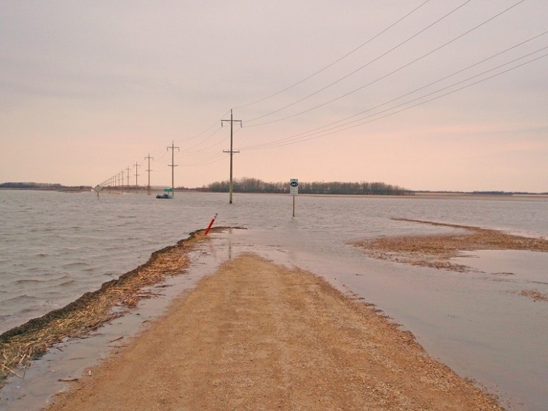
Tragedy strikes in Scotland when a storm surge in the Outer Hebrides washes cars from a causeway
Source
Storm ‘Gero’ (Harwood, 2012) developed over the coast of the northwest US on 8th January 2005 and moved northeastwards, passing to the north of the UK and crossing over Scandinavia. On 11th January, the storm approached Ireland and combined with, and was enhanced, by another low-pressure system located south of Iceland. The central pressure deepened rapidly to about 950 mbars as the storm approached to the northwest of Scotland. The strongest wind gusts of 111 knots [57 m/s] were recorded at Great Dun Fell, Cumbria (Met Office, 2012). It has been suggested that this event took place within a 5 month period during the last 30 years when storminess was higher than normal (Dawson et al. 2011). A few days earlier, during 7th–9th January, storm Gudrun had already passed over the British Isles, Scandinavia and Finland, causing a record storm surge and dramatic shoreline changes on the Estonian coast (Wolf, 2007).
The storm generated a skew surge of between 0.5 and 1.5 m all the way from Holyhead around to Dover. Water levels exceeded the 1 in 5 year return level at 8 sites in Scotland and Whitby. The event generated the highest record return period water levels at 5 sites in Scotland. The highest return period water level was at Tobermory and was 1 in 71 years. The next largest return period of 1 in 70 years was at Kinlochbervie. Here, the 1 in 5 year threshold was exceeded twice on two consecutive high waters, with skew surge values of above 1.0 m. The highest skew surge was at Tobermory and was 1.51 m.
A study which deployed a suite of nested wave models to hindcast this event, suggested the local wave setup was very high, approximately 0.5 m at South Uist, due to large wave heights (up to 14.3 m) entering and rapidly shoaling near-shore (Wolf, 2007; Wolf, 2009). This may have contributed substantially to the total water level.
Pathway
We are unaware of specific information regarding the flood pathways for this event.
Receptor and Consequence
Severe flooding occurred in the Hebrides (Harwood, 2012) and damage was concentrated in Scotland (Met Office, 2012). Tragically, 5 persons were killed when two cars were swept from a causeway on South Uist (Cramb, 2005). Throughout Scotland, roofs were damaged, trees were blown down, roads, bridges, ferry and rail services affected and more than 60,000 people left without electricity (Weathermaster, 2011). A school in Balivanich was damaged, and was later relocated (Richards & Phipps, 2007). In the Shetland Islands, Sumburgh Airport was closed for 3 days and key road links were out of action also (Ball et al. 2008). There was also considerable coastal erosion in some places (Dawson et al. 2011), with severe impacts to areas west of the causeways that link North Uist and Benbecula, Benbecula and South Uist and South Uist and Eriskay (Muir et al. 2013). This storm is also associated with rainfall flooding and three fatalities in Carlisle (Cumbria). In the north of England, there was flooding in quayside areas of Newcastle when the River Tyne burst its banks (BBC, 2005).
During an unspecified time in January 2005, there was coastal flooding Warkworth, Northumberland (Northumberland County Council, 2010). The sea level data indicates this is very likely to have occurred on the 12th January.
Coastal flooding was also reported at Bryggen, Norway (Vannstand.no, 2014).
In the region of Scotland that was affected, the storm is considered the worst in living memory, although from a meteorological standpoint a more severe storm occurred on 11th–12th November 1877.
Summary Table
| Loss of life | 5 people drowned in the Hebrides whilst fleeing their home |
| Residential property | * |
| Evacuation & rescue | * |
| Cost | * |
| Ports | * |
| Transport | Sumburgh Airport (Shetland Islands) was closed, and many roads including key links in the Shetland Islands were damaged |
| Energy | * |
| Public services | A school in Balivanich was closed due to flood damages |
| Water & wastewater | * |
| Livestock | * |
| Agricultural land | * |
| Coastal erosion | “Significant” retreat of dunes in some areas |
| Natural environment | * |
| Cultural heritage | * |
| Coastal defences | * |
Affected Sites
| Name | Return Period ? | Water Level ? | Tide ? | Skew Surge ? | Date ? |
|---|---|---|---|---|---|
| TOBERMORY | 71 | 6.06 | 4.54 | 1.52 | 11th Jan 2005 19:00 |
| KINLOCHBERVIE | 70 | 6.27 | 5.21 | 1.06 | 12th Jan 2005 08:30 |
| WICK | 65 | 4.49 | 3.74 | 0.75 | 12th Jan 2005 12:30 |
| ABERDEEN | 57 | 5.3 | 4.54 | 0.75 | 12th Jan 2005 14:30 |
| ULLAPOOL | 57 | 6.44 | 5.5 | 0.93 | 12th Jan 2005 08:15 |
| STORNOWAY | 17 | 5.89 | 5.19 | 0.69 | 12th Jan 2005 08:00 |
| NORTH SHIELDS | 16 | 6.11 | 5.38 | 0.73 | 12th Jan 2005 16:45 |
| KINLOCHBERVIE | 8 | 5.95 | 4.86 | 1.09 | 11th Jan 2005 20:15 |
| LERWICK | 5 | 2.86 | 2.39 | 0.47 | 12th Jan 2005 12:00 |
We rely on submissions from the public to maintain these images. If you witnessed this event, please help by uploading your photos.

References
- Harwood, P. (2012). Atlantic storm (2005). eSurge. Available at: http://www.storm-surge.info/atlantic-storm-2005 (Accessed: 1 October 2015).
- Met Office, (2012). January 2005 – stormy spells. Available at: http://www.metoffice.gov.uk/climate/uk/interesting/jan2005wind (Accessed: 1 October 2015).
- Dawson, A., Warren, J., Gómez, C. and Ritchie, W. (2011). Weather and coastal flooding history: The Uists and Benebecula. Commissioned report for Comhairle nan Eilan Siar, South Ford Hydrodynamics Study, Aberdeen.
- Wolf, J. (2007). Modelling of waves and set-up for the storm of 11-12 January 2005, Liverpool. Available at: http://nora.nerc.ac.uk/2672/.
- Wolf, J. (2009). Coastal flooding: impacts of coupled wave–surge–tide models. Natural Hazards, 49(2), pp.241–260
- Cramb, A. (2005). ‘Island mourns family swept to death in storm’. The Telegraph. Available at: http://www.telegraph.co.uk/news/uknews/1481163/Island-mourns-family-swept-to-death-in-storm.html.
- Weathermaster, (2011). January 11th / 12th 2005 Storm. Netweather Community. Available at: https://www.netweather.tv/forum/topic/71315-january-11th-12th-2005-storm/ (Accessed: 11 October 2015).
- Richards, L.A.R. and Phipps, P.J., (2007). Managing the impact of climate change on vulnerable areas: a case study of the Western Isles, UK. In R. McInnes et al., eds. Landslides and Climate Change: Challenges and Solutions. Ventnor, Isle of Wight: Proceedings of the International Conference on Landslides and Climate Change, pp. 435–442.
- Ball, T. et al. (2008). Coastal flooding in Scotland: a scoping study. Project FRM10, Dundee, Scotland.
- Muir, D., Dawson, A., Gagnon, A. J. and O’ Mahony, C. (2013). Vulnerability and Adaptation to Extreme Coastal Flooding: an Example from the South Ford Area, Scottish Outer Hebrides. In Conference: ICE Coasts, Marine Structures and Breakwaters 2013. Edinburgh, Scotland: Institute of Civil Engineers.
- BBC, (2005). ‘Third body found in family search’. BBC News. Available at: http://news.bbc.co.uk/1/hi/scotland/4166901.stm (Accessed: 1 October 2015).
- Northumberland County Council, (2010). Level 1 Strategic Flood Risk Assessment. Apppendix A. Document prepared by Scott Wilson Group plc, Morpeth. Available at: http://www.northumberland.gov.uk/default.aspx?page=3458
- Vannstand.no, (2014). Useful to Know. Available at: http://archive-no.com/page/5169835/2014-12-24/http://www.vannstand.no/index.php/nb/articles/help/241-useful-to-know [Accessed October 1, 2015].