Real time sea level data – NTSLF
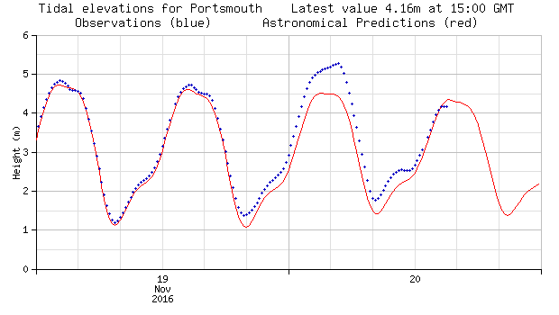
I liked to keep my eye on real-time water level data, particularly during storms. On the National Tidal and Sea Level Facility web-site, which is run by the National Oceanography centre, you can see real-time water level data for the 43 national tide gauge sites. Below is an image from the NTSLF for the Portsmouth Tide gauge, for the recent storm Angus (19-20 November 2016) which caused flooding in Swanage. The red line shows the tidal prediction and the blue line the actually measured water level. You can see that during storm Angus sea levels were around 70-80 cm higher than predicted.